
Free GIS Resume Templates & Examples
Create a professional GIS resume with customizable templates, practical writing tips, and examples. Highlight your GIS software expertise, spatial analysis, mapping skills, technical experience, and project accomplishments to clearly show employers what you can bring to a GIS role.
Real-World Resumes That Get Results
 Free
Free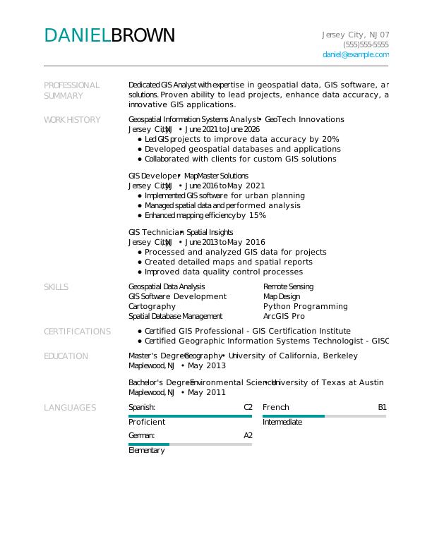



Browse Free Resume Templates
- Accounts Payable
- Adjunct Professor
- Artist
- Auto Mechanic
- Baker
- Business Development Manager
- Business
- Certified Nursing Assistant
- Classic & Traditional
- Cleaner
- College Student
- Concierge
- Construction Worker
- Corporate
- Creative & Unique
- Custodian
- Customer Service
- Dental Assistant
- Direct Support Professional
- Entry-Level
- Flight Attendant
- Hospitality & Food Service
- Front Desk Receptionist
- Healthcare
- High School
- Housekeeping
- Hvac Technician
- Hybrid
- Inventory Manager
- Logistics
- Maintenance
- Management
- Modern
- Mortgage Loan Processor
- Pet Sitter
- Phlebotomist
- Production
- Rbt
- Sales
- Security Services
- Restaurant Server
- Simple & Basic
- Social Work
- Teacher
- Technology
Resume Examples for GIS Roles
GIS resumes can vary depending on the role you’re targeting, from GIS technician and analyst positions to roles focused on cartography, spatial analysis, or GIS management. Explore templates tailored to different GIS careers, then use our Resume Builder to create a professional resume that highlights your experience.
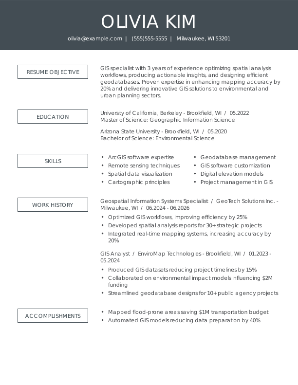
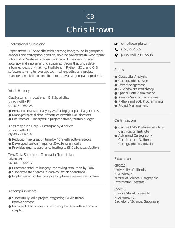
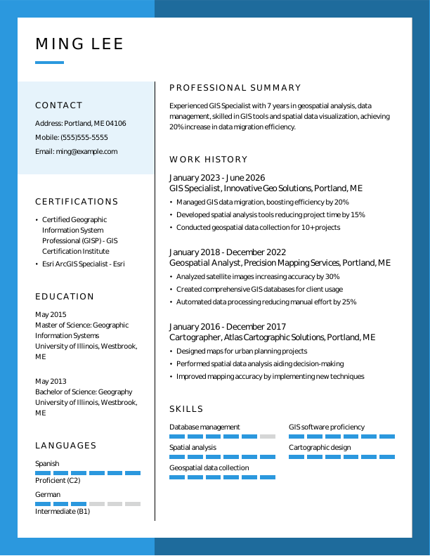
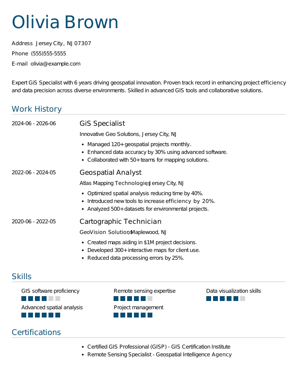
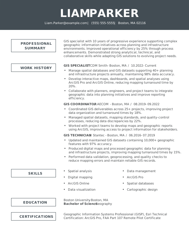
GIS Specialist Resume
A good fit for GIS specialists with experience working with spatial data, mapping, and GIS software, this template highlights technical skills, project experience, and recent accomplishments.
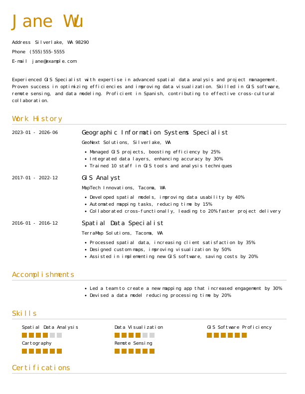
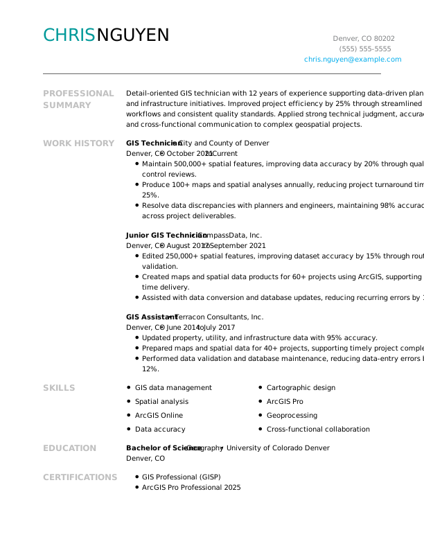
GIS Technician Resume
A good fit for GIS technicians with hands-on experience, this template highlights technical skills, mapping projects, spatial data management, and recent accomplishments.
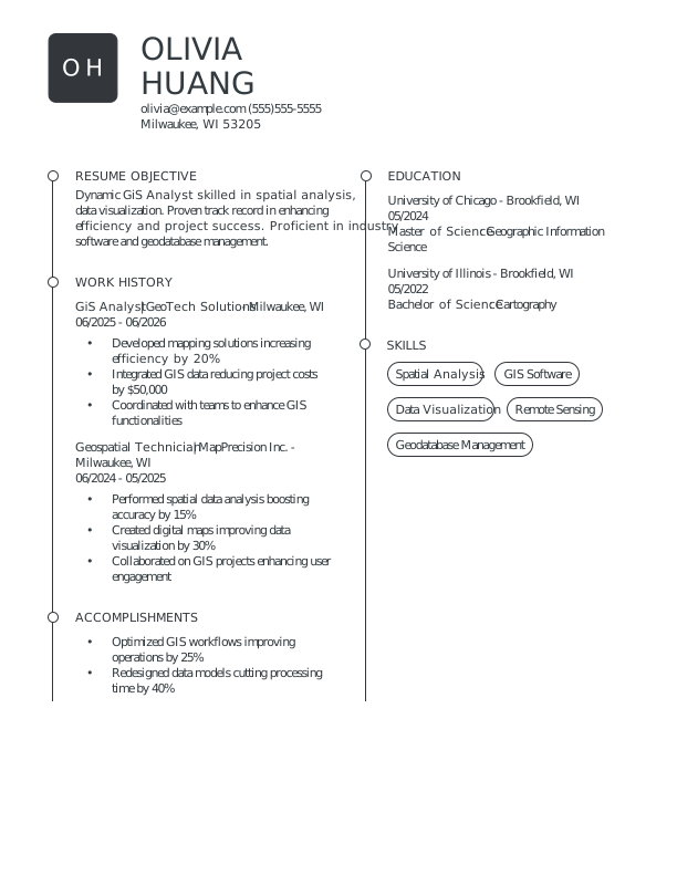
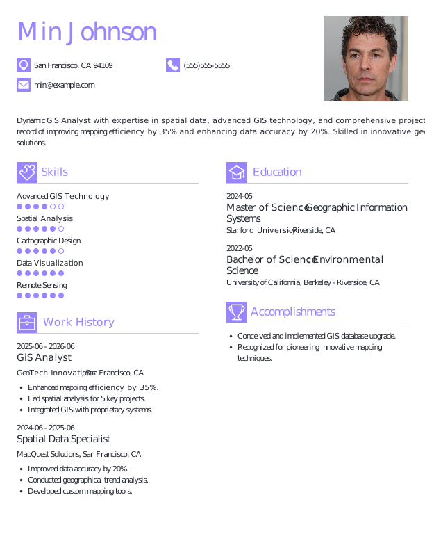
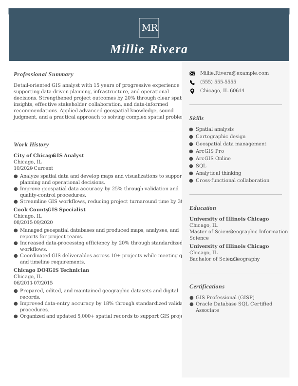
GIS Analyst Resume
A good fit for GIS analysts with hands-on experience, this template highlights spatial analysis, data management, GIS software, and mapping expertise.
GIS Resume Template (Text)
Take this customizable text format of a GIS resume to copy, edit, and personalize directly in your document or file. Explore our resume templates for more designs.
Jin Kim
Spokane, WA 99205
Professional Summary
GIS analyst with 5+ years of experience managing spatial data, creating maps, and performing GIS analysis for environmental and planning projects. Skilled in ArcGIS Pro, spatial data management, cartography, and Python, with experience maintaining geodatabases, analyzing geographic information, and producing clear maps and reports for project teams.
Work Experience
June 2023 – Present
GeoTech Solutions – Spokane, WA
GIS Analyst
- Perform spatial analysis and create maps using ArcGIS Pro to support environmental, planning, and infrastructure projects.
- Maintain and update geodatabases, ensuring spatial data is accurate, organized, and properly documented.
- Integrate data from multiple sources and formats to create standardized GIS layers for project teams.
June 2021 – May 2023
EarthView Analytics – Spokane, WA
GIS Technician
- Edited and maintained spatial datasets using ArcGIS Pro, following established data standards and quality-control procedures.
- Created maps and geographic data products for environmental assessments, land-use projects, and field operations.
- Processed GPS and field-collected data and incorporated updates into project geodatabases.
June 2019 – May 2021
MapMaster Corp. – Spokane, WA
GIS Technician
- Created and updated digital maps and spatial datasets using ArcGIS software.
- Digitized geographic features from aerial imagery and other source data while following project specifications.
- Organized GIS files, metadata, and supporting documentation to improve data accessibility and consistency.
Education
University of California, Berkeley – Berkeley, CA
Master of Science in Geographic Information Science | 2021
University of Washington – Seattle, WA
Bachelor of Science in Environmental Studies | 2019
Certifications
- Geographic Information Systems Professional (GISP) | GIS Certification Institute
- Esri Technical Certification, ArcGIS Pro
Skills
- ArcGIS Pro
- Spatial Analysis
- Geographic Information Systems (GIS)
- Cartography and Map Production
- Spatial Data Management
- Geodatabase Management
- Data Quality Control
- GPS and Field Data Collection
- Remote Sensing
- Python for GIS
- Data Visualization
How to Write a GIS Resume
As a GIS specialist, knowing how to write a resume means mixing your technical skills and relevant experience with a clear format that showcases why you’re the ideal job seeker. Use the guidance below to emphasize your strengths and customize your resume for the positions you’re aiming for.
1. Contact Info
Your contact information should be clear, professional, and easy to find at the top of your resume.
Make sure to include:
- Full name
- Phone number
- Professional email address
- City and state (ZIP code is optional)
- LinkedIn profile or personal portfolio (if relevant)
- RN license number and state (if applicable)
 PRO TIP
Avoid including personal details such as your age, gender, or social media profiles unless specifically requested by the employer.
2. Resume Profile
A resume profile is a brief introductory section, typically two to four sentences long, that outlines your professional identity and key qualifications. It serves as an engaging pitch aimed at hiring managers, designed to grab their interest and motivate them to explore your resume further.
This profile is prominently placed at the top of your resume and can be formatted as either a summary or an objective.
Each format has its unique focus and intent:
- A resume summary highlights relevant expertise, capabilities, and achievements that align with the GIS field. This format is especially useful for job seekers with prior experience or transferable skills who aim to showcase their contributions and effectiveness in geographic information systems.
- A resume objective highlights your career aspirations and what you aim to achieve in your next role. This is particularly beneficial for recent graduates, individuals shifting careers, or those with limited experience, such as coding bootcamp graduates or professionals transitioning into GIS roles.
Let’s take a look at an example of each to see how a resume summary and a resume objective differ:
Gis resume summary example:
GIS analyst with 6+ years of experience managing spatial data, performing geographic analysis, and producing maps for environmental, planning, and infrastructure projects. Proficient in ArcGIS Pro, QGIS, spatial data management, and data visualization. Experienced in maintaining accurate geodatabases, automating GIS workflows, and creating clear maps and reports that support project planning and decision-making.
Gis resume objective example:
Recent Geographic Information Systems graduate seeking an entry-level GIS position where strong analytical, mapping, and data management skills can support geospatial projects. Experienced with ArcGIS Pro, spatial analysis, and geographic data visualization through academic projects and hands-on training, with an interest in applying these skills in environmental, planning, or other GIS-focused settings.
3. Work Experience
The work experience on your resume is an important component of your professional narrative. Employers examine your job history to gauge not only where you’ve worked but also the impact you’ve had on projects and outcomes.
Your background in GIS illustrates how your analytical skills and technical expertise qualify you for the role in spatial data management.
The work experience section should contain:
- Job title
- Employer name and location
- Dates of employment (month/year)
- Three to five bullet points describing your relevant responsibilities and achievements
Tailor your content to reflect the specific GIS role you’re targeting. Start each bullet point with an action verb (like “Analyzed,” “Mapped,” “Integrated”) to create a strong impression of your contributions.
Incorporate quantifiable data whenever possible. Specific metrics and results help illustrate your impact in GIS projects and distinguish you from other job seekers, showcasing your professional value.
In general, consider following the format of:
[action verb] + [responsibility] = [result/achievement]
For example:
Conducted spatial analysis and created detailed maps for 50+ projects, improving data visualization and decision-making processes across multiple departments.
Note that you can also flip the result/achievement with the responsibility:
Increased project efficiency by 30% through implementing advanced GIS tools and techniques for data management.
With these techniques in mind, your resume bullets may look something like:
- Analyzed spatial data and created detailed maps for 15+ projects, improving decision-making processes by 20%.
- Developed geospatial models that improved resource allocation efficiency by 30% across various departments.
- Collaborated with cross-functional teams to implement GIS technology, supporting data-driven strategies without exceeding project timelines.
- Mentored interns in GIS software applications, fostering skills development and promoting best practices within the team.
- Used ArcGIS and QGIS tools to manage and visualize geographic information, streamlining workflows significantly.
4. Skills
The skills section provides a concise overview of your abilities as a GIS professional, showcasing technical expertise and analytical capabilities. This allows hiring managers to quickly assess qualifications for spatial data analysis roles. Skills can be categorized into three distinct groups:
- Soft skills are personal qualities that influence how well GIS professionals collaborate with others.
- Hard skills are specific, quantifiable abilities acquired through education, training, or experience.
- Technical skills are the practical competencies required to operate specific tools and technologies.
5 Soft Skills for Your Resume or CV
- Spatial analysis
- Teamwork and collaboration
- Project management
- Effective communication
- Critical thinking
5 Hard Skills for Your Resume or CV
- GIS software skill (ArcGIS, QGIS)
- Spatial analysis techniques
- Data visualization (Tableau, Power BI)
- Geocoding and mapping services
- Remote sensing applications
In general, aim to showcase a diverse range of relevant skills that align with the job requirements to demonstrate your full professional value.
PRO TIP
If you’re a newer GIS professional, consider placing your skills section near the top of your resume right after your summary. If you have more experience, position this section lower and weave your skills into descriptions of your work history for better context.
5. Education
Understanding how to list education on your resume is important for making a strong impression. Begin with your latest or most relevant degree, clearly stating the type of degree and the institution’s name.
If you have recently graduated, you might also include your graduation year, GPA (if it’s 3.5 or above), honors received, and any relevant coursework to further showcase your qualifications.
Gis resume education section example:
Bachelor of Science in Geographic Information Systems (BSGIS)
California State University, Long Beach, Long Beach, CA
Graduated: 2024 | Magna Cum Laude
PRO TIP
If you’re progressing from an Associate Degree in Geographic Information Systems (GIS) to a Bachelor of Science in GIS, or have earned another relevant degree, list both in reverse-chronological order.
6. Certifications
Including listing certifications on your resume boosts your profile, especially if you lack extensive practical experience. While not always a standard inclusion for all resumes, this section is important for many GIS professionals.
Employers often look for specific credentials, such as Esri ArcGIS certification or Geospatial Intelligence certifications, when hiring for roles in urban planning or environmental analysis.
Make sure to include only those certifications that directly support your qualifications for the position you’re applying for.
Additionally, keep these credentials current and list them clearly to make a strong impression on potential employers.
Gis certification examples:
- Geographic Information Systems Professional (GISP) | GIS Certification Institute | Expires: 01/2028
- Esri ArcGIS Desktop Professional | Esri | Expires: 04/2027
- Certified Geographic Information Systems Technician (CGIST) | National Council of Examiners for Engineering and Surveying | Expires: 09/2027
- Remote Sensing Certification | American Society for Photogrammetry and Remote Sensing | Expires: 06/2028
Start Building Your Job-Winning Resume
Use Your Existing Resume
Import your current resume to transfer your information to one of our professional templates.
Create a New Resume
Start fresh with a template that catches your eye and follow the prompts to add your details.
Tailor Your Work History to Beat the ATS
Your work experience is more than a list of job titles. It’s an opportunity to demonstrate the measurable impact you’ve had on projects, analyses, and geospatial solutions.
This approach can also lead to a more ATS-friendly resume that can be easily scanned by applicant tracking systems (ATS).
To create an effective work history, tailor it to the GIS role you’re applying for by incorporating relevant keywords and terminology.
Begin by carefully analyzing the job description. Identify frequently mentioned skills, software, or methodologies, and strive to reflect those elements in your experience descriptions when possible.
What’s a Fair GIS Salary?
Understanding GIS salaries across the country helps you evaluate job opportunities, negotiate better compensation, and make informed career decisions.
The data from the U.S. Bureau of Labor Statistics (BLS) reflects the most recent nationwide averages for geographic information systems professionals. Keep in mind that factors like location, years of experience, certifications, and specialization can all influence your actual salary.
GIS analysts working in urban planning or environmental consulting often earn more than those in other sectors, while advanced roles such as GIS managers or specialists in remote sensing typically command higher pay due to their expertise.
Key Takeaways
- Customize your resume for each job application. Reflect the language and requirements of the job description to please both ATS and hiring managers.
- Highlight quantifiable accomplishments that demonstrate your expertise. Use specific metrics (e.g., project completion rates, data accuracy percentages, software skill) to improve your profile.
- Select a resume format that aligns with your experience. Entry-level job seekers might opt for a functional layout, while seasoned professionals usually prefer a reverse-chronological structure.
More Resume & CV Examples
- Actuary
- Agile Project Manager
- Ai Product Manager
- Analyst
- Aws Devops Engineer
- Bioinformatics
- Biology
- Biostatistician
- Business Analyst
- Business Intelligence
- Chief Data Officer
- Chief Information Officer
- Clinical Data Manager
- Compensation Analyst
- Computer
- Computer Science
- Computer Technician
- CTO
- Cyber Security
- Data Analyst
- Data Annotator
- Data Center Technician
- Data Engineer
- Data Scientist
- Database Administrator
- Digital Project Manager
- Environmental Science
- Epic Analyst
- Health Informatics
- Healthcare Data Analyst
- Healthcare It
- Hris Analyst
- Implementation Specialist
- Intelligence Analyst
- It Help Desk
- It Manager
- It Project Manager
- IT
- It Support
- It Support Specialist
- It Technician
- Math
- Network Administrator
- Network Engineer
- Physical Science
- Product Owner
- Quantitative Analyst
- Quantitative Researcher
- Salesforce Administrator
- Science
- Scientist
- Service Desk Analyst
- Social Science
- Systems Administrator
- Tableau Developer
- Technical Program Manager
- Technical Project Manager
- Technical Support Specialist
- IT Developer
Cover Letters for Your Resume
Browse our library of cover letter examples to complete your application. A resume will have a better chance of getting noticed.
Frequently Asked Questions
Last Update:
What resume format should I use for my GIS resume?
There are three main resume formats to consider for a GIS position. The format you choose should reflect your experience and highlight the skills most relevant to GIS work, whether technical or analytical:
- Chronological: The most widely used format, a chronological resume emphasizes your work experience by detailing responsibilities and achievements in reverse order. This approach is particularly suitable for applicants with relevant job history that reinforces their qualifications and demonstrates a clear career progression.
- Functional: Also known as a skills-based resume, the functional resume emphasizes a qualifications summary and an expanded skills section to showcase your GIS expertise. This format minimizes focus on work history, which is helpful for job seekers lacking relevant experience or those transitioning into the field.
- Combination: A combination resume integrates both chronological and functional elements, featuring a skills section alongside work experience. This format allows GIS professionals to emphasize their technical abilities while also showcasing their career development, making it suitable for those advancing in the field or transitioning to new roles.
Should I include a cover letter with my resume?
Yes, you should include a cover letter with your GIS job application. A well-crafted cover letter helps you articulate your passion for the field and elaborate on skills or projects that your resume might not fully convey.
This personalized touch can make a significant difference by showing hiring managers that you’re genuinely interested in their organization and role.
How long should a GIS resume be?
For professionals with less than 10 years of experience, a resume should typically be limited to one page. This allows you to present your qualifications, skills, and achievements in a clear and concise manner. Focus on relevant work history, education, and certifications to make the best impression.
For those in senior or specialized roles, it’s acceptable to extend the resume to two pages. Ensure that all content remains focused on your expertise and significant accomplishments. Avoid unnecessary details that could detract from your core message.
What keywords should I include to pass ATS?
To ensure your resume makes it through ATS filters, focus on incorporating keywords and phrases directly from the job listing. Look for specific terms related to GIS, such as “geospatial analysis,” “cartography,” or “remote sensing.” Using these keywords will help demonstrate that you meet the qualifications for the position.
Additionally, highlight relevant certifications like Certified Geographic Information Systems Professional and technical tools you’re proficient in, such as ArcGIS or QGIS.
By showcasing these skills, you improve your chances of capturing the attention of hiring managers who are looking for applicants with a solid background in GIS.

Elizabeth Muenzen is a Certified Professional Resume Writer (CPRW) and member of the Professional Association of Resume Writers & Career Coaches who empowers job seekers to take control of their career paths using Monster’s comprehensive job search and resume tools.
See More From Elizabeth MuenzenExplore Related Career Advice


How to Put Transferable Skills on Your Resume: 120 Skills, Examples, & Tips

Updated:
Aug 27, 2026
|

16 min read


How to Write a Functional Resume (Formatting Tips, Template, & Examples)
Updated:
Aug 7, 2026
|
17 min read


Functional vs Chronological Resume: Which Format Is Right for You?
Updated:
Aug 3, 2026
|
16 min read

100+ Resume Adjectives to Help You Write a Stronger Resume in 2026 (With Examples)
Updated:
Jul 30, 2026
|
12 min read